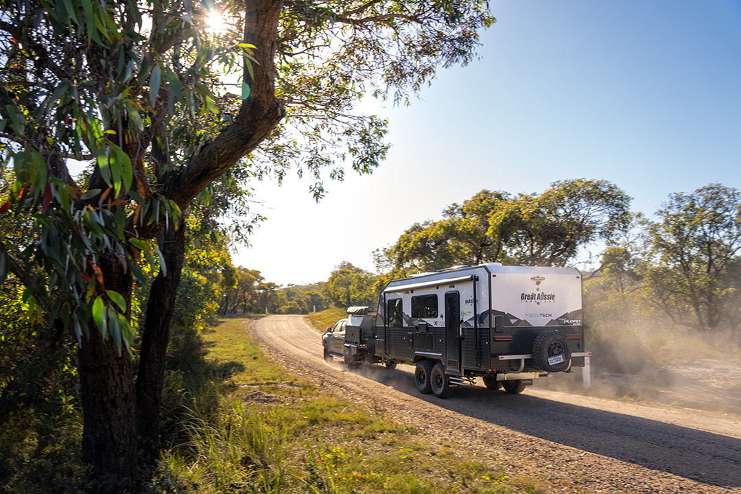
The Birdsville Track: South Australia to Queensland
Once renowned as one of the most challenging tracks in the country, the Birdsville Track has been upgraded over the years but has this made it less inviting?
Is the Birdsville track still a hard slog for travellers from Birdsville to Marree? Or has the number of caravans heading to Birdsville for the Big Red Bash and Birdsville Races done what Tom Kruse couldn't do to make the journey a lot less challenging?
The Birdsville Track was established by drover Percy Burt in the 1860s as a stock route. By 1916, bores had been sunk at roughly 40km intervals, making it a reliable route featuring a number of cattle stations and great campsites.
It’s been nearly 15 years since I last drove the Birdsville Track, so it will be interesting to see if my perception of it now being a Sunday drive holds true.
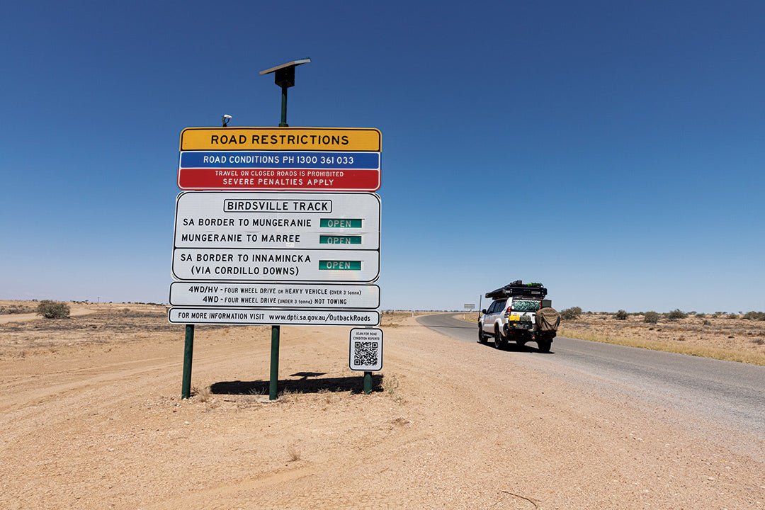
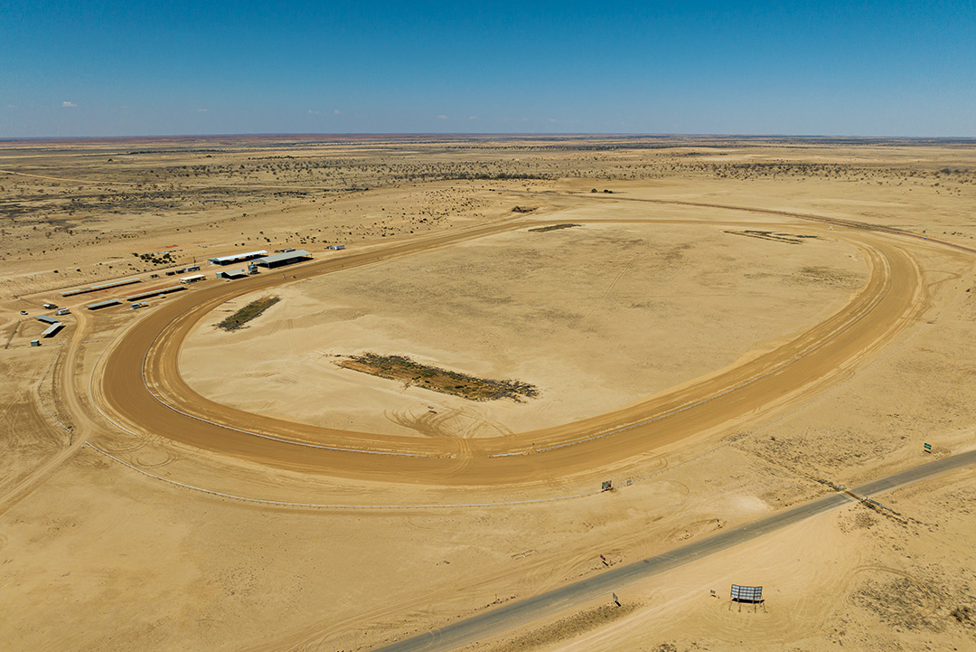
At the start of my journey in Birdsville, I crossed the Diamantina River, passing the racecourse on my left. This is where the Birdsville Races are held on the first Saturday in September and the town becomes inundated with 7000 racegoers. Crossing the border into South Australia, the landscape opens up as the track follows a dune past Pandie Pandie Station. Beware of cattle here as the road is unfenced.
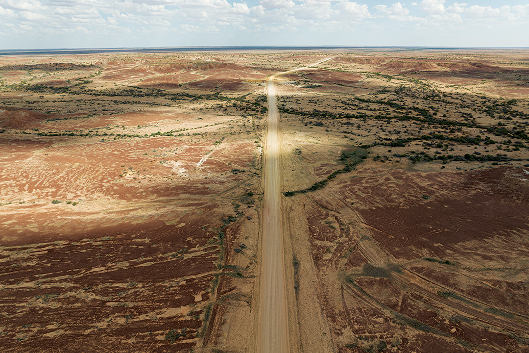
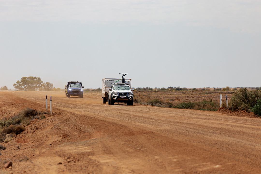
As I travelled south, the road surface conditions were excellent and I enjoyed a smooth run, better than on most bitumen roads. Considering the amount of traffic that the track has for the Birdsville Races and Big Red Bash, as well as the amount of rain that Birdsville had experienced this year, I was surprised by the quality of the dirt road.
Behind one of the dunes to the east are the graves of the Page family who tragically died back in 1963. Their car broke down and they tried to walk to safety but unfortunately perished in the heat. This is harsh country, even now, and you should always ensure that you carry plenty of water, fuel and food, just in case.
Burke, Wills and King also passed this way on their ill-fated journey back from the Gulf of Carpentaria. They camped next to the Diamantina River, 3km from Birdsville and blazed the camp number into a tree that has since grown over. This is said to be one of the final camps before they reached Innamincka. You can still access the signposted site.
Gibber country
I find it hard to fathom how explorers like Sturt and Burke and Wills travelled through the Sturt Stony Desert as this is gibber country. The pebble-sized rocks that carpet the plains as far as the eye can see would've been punishing on the feet of the horses, camels and members of the exploring parties. Thankfully, the road is no longer covered in gibber rocks, it is now regularly graded to make it more user-friendly.
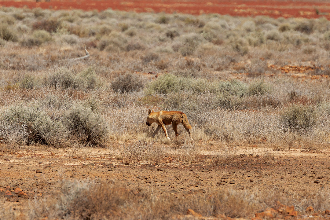
Not far past the southern end of Koonchera Dune is the junction with the Walkers Crossing Track which, when open, is a beautiful drive if you are heading to or from Innamincka. I spotted a dingo just after the turn-off as it crossed the road in front of me before disappearing into the scrub.
The Inside Track meets the Birdsville Track near here. It has been closed for the past few years as it floods regularly and had water across the track stretching for 23km in September 2023. I was lucky enough to drive the Inside Track 20 years ago and it is a stunning drive through the Sturt Stony Desert and the Diamantina River floodplain.
I soon reached the roadside stop at Tippipila Creek, where a large population of bush flies welcomed me, which was not surprising as cattle were seeking relief from the heat under trees in the creek bed. At this free campsite, you’ll find a large open space covered in gibber with flushing toilets the only facility.
The quality of the road is surprisingly great compared to previously — rough, sandy and slow going — but that was before money was spent upgrading the track for those heading to Birdsville for the Big Red Bash or the races. It has felt a bit like a Sunday drive so far, with constant speeds possible.
On reaching Clifton Hills Station, the road turned to tyre-shredding stones, and it was rough and dusty too. This section of the track scouts the Diamantina floodplain, so the stones protect the black soil below. Once past the station, the road crosses several waterways with steep entry and exit, so if you're towing, take care, and reduce your speed through the washouts.
Diverse deserts
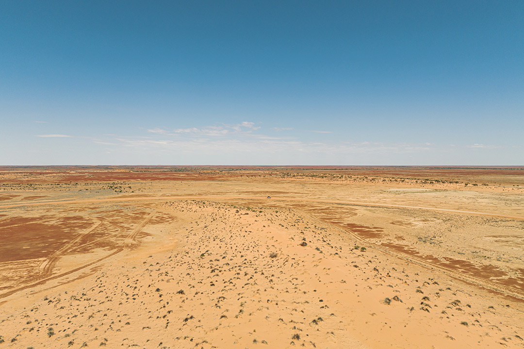
The Birdsville Track passes through several deserts, starting with the Munga-Thirri-Simpson Desert in the north, then tracks through the Sturt Stony Desert, the Strzelecki Desert and the Tirari Desert. This is what makes the landscape along the track so diverse.
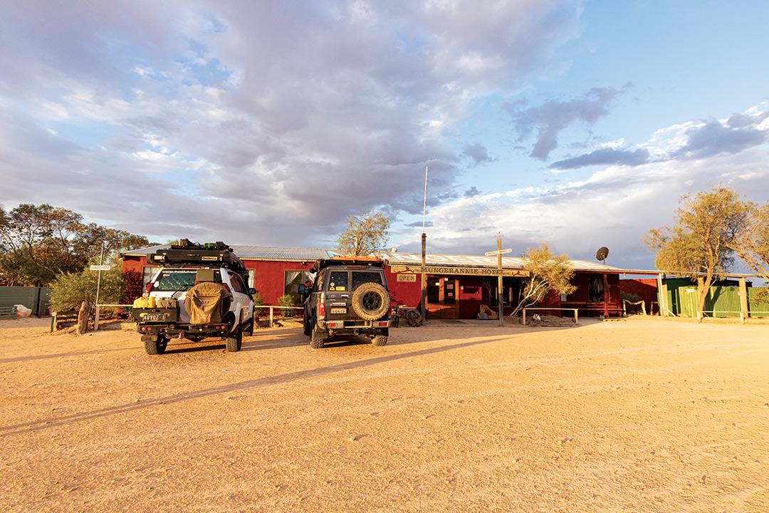
There was plenty of water at Two Wells Bore and Mirra Mitta Bore and there was plenty of birdlife. I knew that once I passed through the visually splendid Mungeranie Gap, it wasn’t too far to the Mungerannie Hotel. As rain clouds were approaching from the west, I hoped to reach the hotel before it hit.
Just before Mungerannie is the turn-off to Kalamurina Wildlife Sanctuary, where once travellers could camp and then explore some of the ancient cliffs, however now a tour must be booked with Outback Spirit to go out there. Kalamurina is a vast desert wilderness, covering a remarkable 679,000 hectares at the intersection of three central deserts: the Munga-Thirri-Simpson Desert, the Tirari Desert and the Sturt Stony Desert.
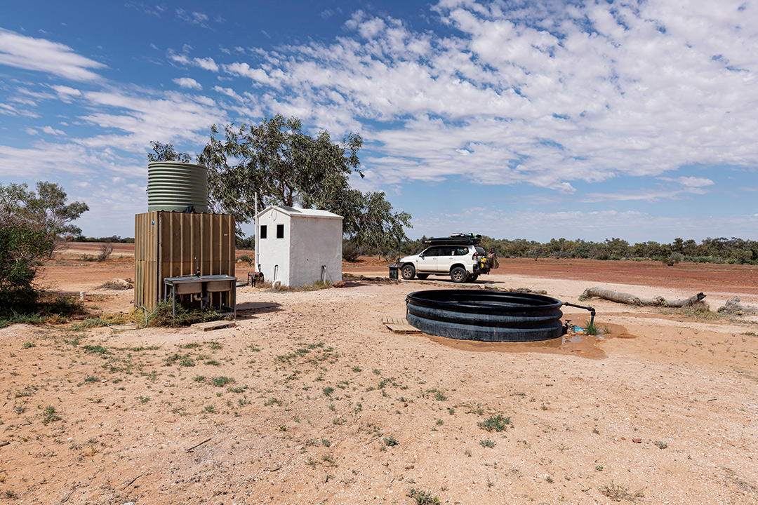
Sadly, the wetlands at Mungerannie are dry, though it is no fault of the hotel. The hotel was recently sold, and the new owners had access to the Mungaranie bore revoked, so currently the hotel has to truck water in. Camping is available at the hotel for $10 per night, which provides access to the toilets, hot showers and free wi-fi.
It was nice to meet the new owners of the Mungerannie Hotel, the previous owner was a real outback character, but the hotel needs some love, and the new owners have some grand plans to fix it and the dry waterhole. A dust storm swept through before a quick dousing of rain and then the sky cleared just in time for a colourful sunset. I dined at the hotel and was not disappointed, the quality of the food, the friendly service and the ambience were all excellent.
The next morning, rain was falling which was good as the hotel relies on fresh rainwater for its coffee machine and, as I departed the Mungerannie Hotel with a ham and cheese toasty on sourdough bread, I had to use the windscreen wipers for the first time in months, albeit only briefly.
It wasn't long before I'd driven out of the rain band, and as I moved further south, the clouds disappeared, and the sun came out. The road conditions were perfect, and it was an easy run down to the turn-off to the ruins of the Mulka Store. George ‘Poddy’ Aiston was a remarkable character who built the store in 1925 and carried a broad range of supplies. George passed away in 1943 and his wife Mabel ran the store until 1951.
A little further on, the track crossed the Natterannie Sandhills, the toughest challenge for Tom Kruse and his Leyland Badger on the Birdsville Track mail run from the 1930s to the 1960s. The sandhills are capped now, so they are no longer daunting.
As I crossed Cooper Creek it was slower going as the track winds its way across the creek bed. Gone are the river rocks that once made it a bumpy crossing. It’s now a well-defined road with some corrugations especially on the bends. Enjoy the Coolabahs, a nice change from the landscape I’d seen on my way drive from Birdsville.
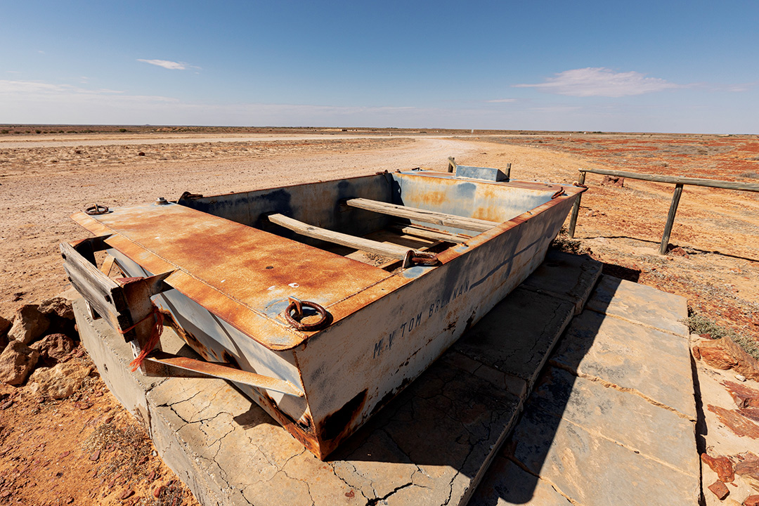
There is a designated campsite on the southern side which has drop toilets. It is close to the road, so you’d get covered in dust if the wind blew in that direction as vehicles passed by. Check out the M.V Tom Brennan memorial, which was once the barge used to cross Cooper Creek when in flood.
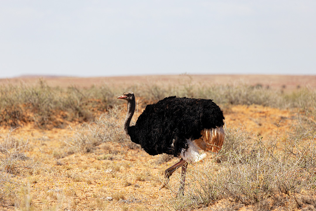
An ostrich on the track
It’s hard to miss the big steel cross at Etadunna Station. Around 1867, German Lutheran missionaries established the Bethesda Mission at nearby Lake Killalpaninna. Two outstations were built, one at Kopperamanna, on the shore of Lake Kopperamanna, and the other at Etadunna which is now a cattle station, working hard to make a living on the Birdsville Track.
Camping is not permitted at the nearby Cannuwaukaninna Creek as it’s a stock watering point for Etadunna. Take care in the floodways south of this creek as they have steep entries and exits so take care with your caravan or camper trailer. There is good camping at Coolabah Campground at Dulkaninna. It’s $25 per vehicle per night with flushing toilets, hot showers and a shelter shed. There is a fire pit, but you must BYO wood.
I kid you not, I spotted an ostrich on the Birdsville track. I may have had a couple of drinks the previous night, but it was definitely an ostrich. Thankfully I was able to photograph it to prove it.
The next point of interest is Clayton Bore, a fantastic campsite where you can enjoy a hot shower, toilets and of course the famous hot artesian bath, which is a great experience. Camping is $20 per car per night and $5 showers for day users.
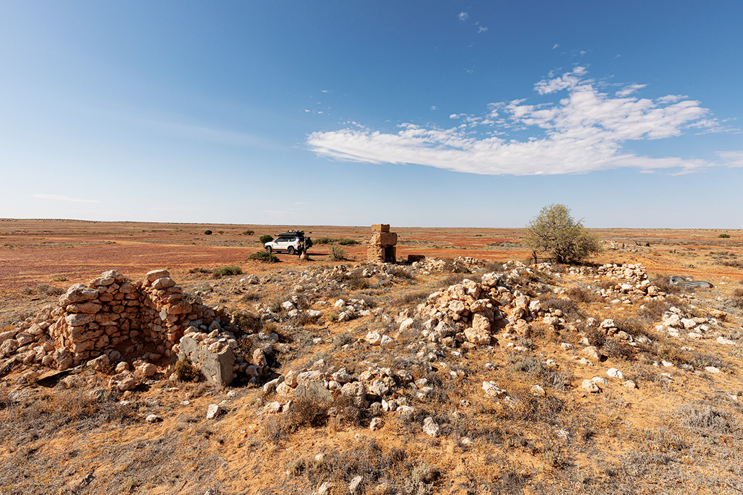
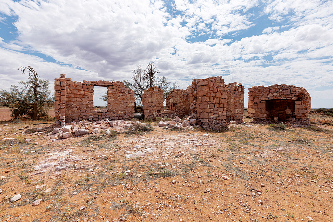
It was sad to see how much the Lake Harry ruins have deteriorated. Does anyone care about trying to preserve the building? The ruins have a story to tell, so why do we let these buildings disappear into a pile of rubble, I don't get it.
Lake Harry was once an experimental date palm plantation that began in 1895 and within a couple of years had more than 2500 palms watered by a nearby well. Unfortunately, the palms had to be hand-pollinated which was uneconomical and not overly successful. Drought, crows and cockatoos made it difficult for Lake Harry and the place was abandoned in the 1940s.
My journey along the Birdsville Track concluded at Marree, a historic railway town. There is plenty to discover in this small town, including the Ghan Railway at the old station, Tom Kruse at the Marree Hotel and the old mosque opposite the general store.
So, did it feel like the Birdsville Track was a Sunday drive? I don’t think so. While the road conditions have certainly improved in recent years, I doubt it will ever be covered in bitumen like the Strzelecki Track. The track still passes through a remote area of outback Australia and conditions can change very quickly, especially when it rains. With its variable road conditions, it’s a track that should be treated with respect. Reduce your tyre pressures and your speed and enjoy the drive. Reduced speed provides an opportunity to take in the diverse landscape, flora and fauna, it is still a beautiful drive.
Travel planner
The Birdsville Track runs 517km from southwest Queensland to northeast South Australia.
Birdsville is 1585km from Brisbane, and Marree is 650km north of Adelaide.
Facilities along the track:
- Birdsville has accommodation, camping, fuel, basic supplies (Birdsville Caravan Park and the Birdsville Hotel are some popular options).
- Tippipilla Creek offers bush camping, flushing toilets
- Mungerannie Hotel has accommodation, camping, fuel, basic supplies, showers and flushing toilets, meals and free wi-fi
- Cooper Creek offers bush camping, flushing toilets
- Dulkaninna Station offers bush camping, showers, flushing toilets, shelter shed
- Clayton Wetlands Campground offers bush camping, showers, flushing toilets, hot artesian baths
- Marree has accommodation, camping, fuel, basic supplies
The best time to visit is during the cooler dry season from April to September. The summer months prove to be too hot to many explorers, and some sites such as Munga-Thirri National Park (famous for the Big Red sand dune) close due to the extreme heat.
Prepare to be self-reliant during your journey as services are limited along the track. Carry plenty of food, water and fuel, an air compressor and tyre deflator, a first aid kit and snake bite kit and a satellite phone or Starlink for communications.
THE NEXT STEP
Are you ready to experience the freedom of the open road? Don't wait - Find your dream getaway now!
RELATED ARTICLES:
The lost worlds of Limmen National Park, Northern Territory