Murrumbidgee River NSW, ACT and VIC
The Murrumbidgee oozed a darker, muddy brown plume of water into the already buff coloured stream of the Murray River. The now much sadly depleted flow of the 'Bidgee merges with the stronger current of the bigger, wider and more noble stream of the mighty Murray, north of present day Swan Hill in the north-west of Victoria.
It's a far cry from explorer Charles Sturt's day when in 1830 he states in his diary: “... such was the force with which we had been shot out of the Morumbidgee, that we were carried nearly to the bank opposite…”
We had a quick celebration on reaching our goal and, taking a furtive glance at the overhanging trees threatening the small campsite here, we headed downstream and found our way a few hundred metres to a great camping spot.
First named by Thomas Mitchel as 'Passage Camp', it was here in 1836 that he stood on the cusp of everlasting fame as the discoverer of 'Australia Felix'. The sandy beach that had greeted him is still a delight today and with no one else around and no overhanging gums to bother us we had a perfect setting to set the camper up — and a fitting place to end our journey down the often overlooked but immensely important Murrumbidgee River.
STORMY WEATHER
Our travels down this natural artery, linking the snow-clad mountains of the Australian Alps with the dusty saltbush plains of western New South Wales had started 10 days earlier, but not without incident. We had just turned off the Hume Highway and were heading into the Snowy Mountains when the first flashes of lightning heralded the approach of a summer storm.
It was a raging tempest; the violent wind whacking and swirling the trees around, leaves and small branches being flung from them like chaff from a giant thrashing machine. Thunder rumbled and reverberated across our universe while lightning slashed across the blackened sky in long, single filaments that linked heaven and Earth with brilliant ephemeral tethers.
Then the rain hit, thumping us with giant buckets of water being thrown over the windscreen in one continuous torrent, assaulting all our senses with the noise, mayhem and restricted vision. For the next 10 minutes Mother Nature pounded us as we drove, albeit slowly, then stopped, along a bitumen road absolutely covered in leaves and twigs while dodging around bigger branches torn from the trees and dumped unceremoniously onto the tarmac.
By the time we reached Tumut, just a drizzle of rain remained of the storm, but over the next 10 days we were to find ourselves continually reminded of the tempest that had swept in from the west and battered the forest and trees along the great river we had come to check out.
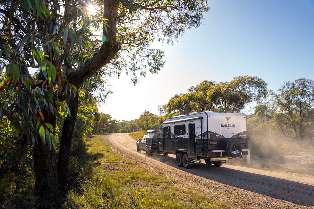
Heading south on the Snowy Mountains Highway we had then followed the Long Plains Road through Kosciuszko NP to the Peppercorn Trail, north of the tourist attraction of the Yarrangobilly Caves. Knowing the Peppercorn Trail was closed to motorised vehicles some distance off the main Long Plains Road, I had brought my mountain bike along to follow this trail west to the source of the Murrumbidgee, which is close to and just south of Peppercorn Hill.
My first foray took me along the start of the trail to a camping spot tucked in close to a copse of snow gums overlooking the boggy flats where the river gathers more water to make it more than just a trickle. The track finished here, but as I had also discovered, it can be accessed by vehicle — I called it Headwater Camp and it’s not a bad little spot to throw down a swag or set up the camper; you are almost guaranteed not to be disturbed.
From here I walked across the bog to the main channel of the nascent river and followed that upstream and down before heading back to the bike and backtracking to find where the now fainter and less used Peppercorn Trail had diverted from the more popular vehicle track I had ended up on.
About 2km west of the Long Plains Road the Peppercorn Trail crosses the fledgling Murrumbidgee on a bridge, where the river is about half a metre wide and where a locked gate indicates the start of the MVO trail. I pushed off west following the two-wheel ruts across the plain in the footsteps of a mob of dingos that had used the same track just a few hours previously. I saw no sign of them but there were a few groups of wild horses around that shook their heads, whinnied and bolted for the perceived protection of the nearby snowgums.
This trail then enters the tree line and swings north climbing the low hill before swinging westward again. From near here it's a short walk through forest and across swampy ground to the mapped source of the river.
IT’S PLAIN TO SEE
Returning to the ‘Cruiser I gladly traded two wheels for four and headed back out onto the Long Plains Road. A little distance south and you can veer left onto the Blue Waterholes Firetrail, which will take you about 7km to the historic and restored Coolamine Homestead, which is always worth a wander around.
All through the Snowy Mountains, these high plains were first used during the 1830s by pioneer graziers, who brought their flocks of sheep and cattle to these verdant grasslands over the summer months. Homesteads and huts were built and the grazing continued until 1958 when all cattle and sheep were removed to protect the water catchment for the then fledgling Snowy Mountain Scheme, the Kosciuszko area having been declared earlier, in 1944, as a State Park.
Another 3km along the picturesque Waterholes trail is the Magpie Flat Camping Area while just down the hill are the very pleasant Blue Waterholes themselves.
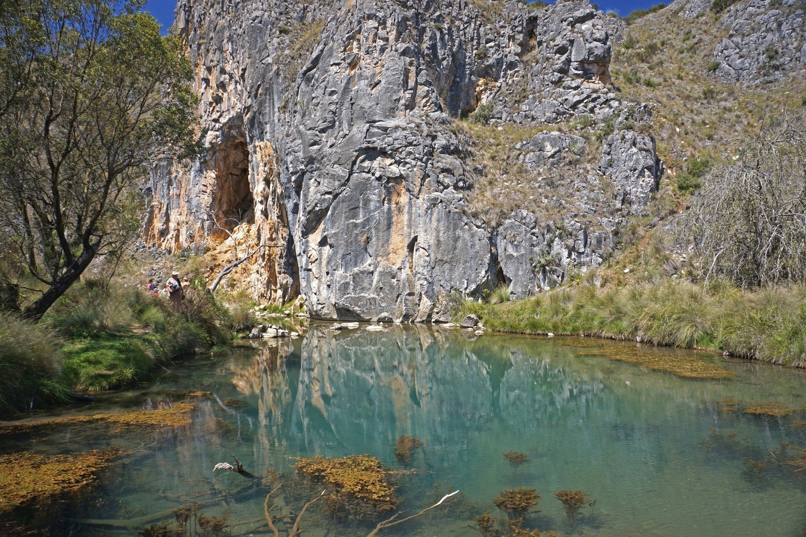
Here are also some limestone caves which can be explored if that is your bent, while a couple of walking trails lead to other points of interest.
Backtracking along the Long Plain Road you'll come to the turn-off to Cooinbil Hut where there is another camping area in this delightful region of high plains. Continuing south along the main road you soon cross the Murrumbidgee River, the road now paralleling the stream for the next 10km or so. Opposite the junction to Long Plain Hut (camping is also possible here) we took the Port Phillip Trail, crossing the Murrumbidgee on a sharpish tight turn before coming to yet another campsite at Ghost Gully, this one popular with horse riders who love riding across these vast open snowgum studded plains.
Pushing on along the Port Phillip Trail you'll come to the wide open area which forms, when the dam is full, the backwaters of the Tantangara Reservoir. At times the lake formed by the dam is too high, closing off access further east along the trail, but this time though there was no issue, the ford across the narrow tributary being open.
The green grass of the exposed floodplain of the dam was being cropped to lawn-like consistency by groups of wild horses, which seemed to be in very large numbers through here. If the NSW Parks & Wildlife department are serious about ridding Kosciuszko of its feral horses, I can give them a tip; start around here!
Just east of the grassy floodplain of the dam we came to the well-kept Currango Homestead and its 20 or so outbuildings. This historic homestead was built in 1895 and has been continually occupied since, with the homestead now offering pleasant rustic accommodation.
Our route then took us south along Pocket Saddles Road, which passes through some steep country before dropping down to another crossing of the Murrumbidgee, this time just below the Tantangara dam wall. This is the first impoundment on the stream, a relatively small one, used to control the flow of water of the river for irrigation and power purposes. Here we met up with a contract pig hunter who was scouring the area for feral pigs, which are now a major concern for the park's managers.
The river heads south-east after its expulsion from the dam and we met it again north of Adaminaby where it was running through pockets of delightful farm land, some of it irrigated by the river itself — a sign of things to come further downstream.
We travelled along bush roads keeping as close to the river as possible, the area through here being alive with kangaroos; in fact, while we had seen plenty of grey kangaroos in the national park, out here we had more variety including greys, smaller black (or swamp) wallabies and stocky euros, or hill wallaroos, to keep an eye out for and to dodge as they hammered, tails pounding, across our track.
By the time we found our way to the historic Bredbo Inn, the river was flowing north having changed direction suddenly as it cut through a gap in the Clear Range just north of Cooma where it then paralleled the grey-green-clad ridges of the Namadgi NP.
A CAPITAL ADVENTURE
Gathering succour from other streams, the Murrumbidgee flows into the ACT and we crossed it again at Angle Crossing and followed the now defined and picturesque river valley northwards to the village of Tharwa, less than 40km from the heart of our nation's capital, but much further away in history and personality.
The whole length of the river in the ACT is protected in the Murrumbidgee River Corridor which adjoins a number of other conservation reserves. While there are some very pleasant spots to swim, canoe and picnic along the river through the ACT, there is only one spot where you can camp and that is at the well set-up Cotter Campground at the junction of the Cotter and Murrumbidgee rivers. It's a great place to enjoy the river and to explore nearby Canberra, if you feel the need.
We pushed on, crossing the river where the stream enters the backed-up waters of Burrinjuck Dam, the biggest reservoir on the Murrumbidgee. We stopped for the night at the Burrinjuck Waters State Park, a well set-up and large camping ground on the edge of the lake that provides a top camping spot for those who want to waterski, paddle, or fish the large expanse of water here.
Below Burrinjuck the vigorous Tumut River, enhanced by other streams rising in the Alps, joins the Murrumbidgee and the river flows strongly and steadily past the historic town of Gundagai. We stopped for the night in the Currawarna State Forest, out of the way of any overhanging red gum branches, our phobia being fed by the sight of numerous large trees and limbs lying scattered over parts of the track and in camping spots.
So our little expedition continued down the river passing a heap of potential camping and fishing spots including Sandy Beach near the small village of Wantabadgery. Here you'll also find a monument to the 'Hero of Wantabadgery', Senior Constable Edward Bowen, who was shot in the neck while trying to apprehend a drunken Captain Moonlite and members of his gang in November 1879. The gang had earlier held up the Wantabadgery station and taken a few hostages before helping themselves to food and drink. Thinking that was all such a good idea they retired to the nearby pub doing it all again, taking more hostages and helping themselves to the food and grog. They were soon surrounded by police from Gundagai and while some of the bushrangers were killed in the following shoot-out, the ol' Captain was captured; he was hung in Sydney in January 1880.
Further along the river we checked out the Berembed Weir (the south side of the river is best) and 5-Mile Reserve east of Narrandera, the latter actually on the Bundidgerry Creek, an anabranch of the main river and an ideal spot for canoeing and bird watching. Downstream of Narrandera we explored the largest section of the Murrumbidgee River NP, which features a dozen or so little used sandy beaches and that evening we camped in the Willbriggie Reserve near the small township of Darlington Point.
Next day after checking out numerous sites along the river we came into Hay and found our way to Sandy Point, a popular camping area before pushing onto the small town of Maude where the nearby Maude Weir and its waters make for yet another choice for a pleasant camp. We used to hunt pigs up this way and I hadn't been here for more than 30 years so it was good to see the old Maude pub again which offers camping, good meals and, 'the best piss on the Bidgee'.
Our next overnight stop was in the expansive Yanga NP just south of Balranald. Up until 2005, when national parks took it over, this was one of the biggest and most prosperous sheep stations around. Again it was a property we used to hunt feral pigs on, but such pleasures are strictly curtailed these days. Still, you now have the opportunity to explore the shearing shed and outbuildings and the impressive 1850s pine log homestead, located on a high isthmus of land between the two bodies of water that make up the Yanga Lakes; it’s a place not to miss!
Following the river downstream we were disappointed to find little public access to the Murrumbidgee, our route ending near the homestead that lies close to the junction of the Murrumbidgee with the mighty Murray. We opted to cut our losses and headed back to the bitumen and crossed the Murray into Victoria where we found our way through state forest and tall, crowding red gums to the confluence of the two great streams.
Our brief recce of the Murrumbidgee was over but there's no doubt we'll be back with a bit more time and a canoe or a small tinnie to enjoy this fabulous inland stream that is so often overlooked by travellers. You should give it a try as well!